Raigad
Type: Hill Fort
Region: District Raigad
Height: 2,700 ft
Base Village: Pachad
Food and Accomodation :
Food and water is available in plenty on the fort. food is provided by the locals staying the fort. MTDC also provides food. as regards accomodation, MTDC is the best option for stay at Raigad. there is also a privately owned Dormitory and rooms just besides the Gangasagar lake.
How to Reach :
Nearest railway station is Veer on the Konkan Railway. Nearest airports are at Pune and Mumbai. Via road Raigad can be reached from Mumbai, Pune, and Mahad. the closest ST depot is Mahad. Buses are available from Mahad at Regular interval to the base village of Pachad. Some private vehicles on sharing basis are also available from Mahad To Raigad Fort. Ropeways are also available to top of the fort from the village of Hirkaniwadi.
Nearest railway station is Veer on the Konkan Railway. Nearest airports are at Pune and Mumbai. Via road Raigad can be reached from Mumbai, Pune, and Mahad. the closest ST depot is Mahad. Buses are available from Mahad at Regular interval to the base village of Pachad. Some private vehicles on sharing basis are also available from Mahad To Raigad Fort. Ropeways are also available to top of the fort from the village of Hirkaniwadi.
Best time to visit :
October to March
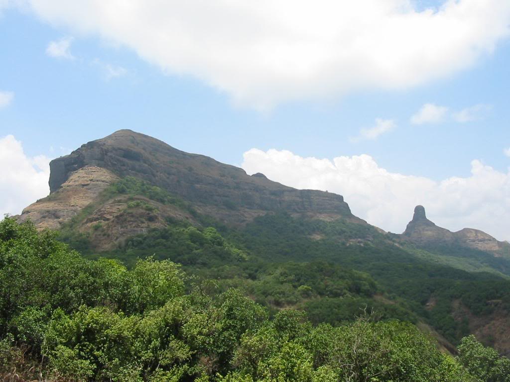
ABOUT:
Raigad fort is located around 2850 feets high from the sea level. The fort is situated at highest peak of Sahyadri Mountains and because of that, fort gets the protection naturally. In 1664, King Shivaji declared Raigad as the capital of his empire. Shiv Rajyabhishek (crowning ceremony of King Shivaji) is an important event in the History of India. In April 1680, the King Shivaji passed away and Aurangzeb taken charge of the fort after beating Shivaji’s son Chhatrapati Sambhaji. Again Chhatrapati Shahu’s army gets the fort in 1734. From 1734 to 1758 Peshavas ruled Raigad Fort. British Officer Colonel Prarther attacked on Raigad Fort in 1818 and destroyed most of structures including King Shivaji’s and Queen’s palaces. They got around Rs.500,000/- in form of gold coins as hoard.
In 1656 A.D. Chhatrapati Shivaji Maharaj got the charge of Fortress of Rairi from Jawali’s More. He renovated and expanded it and also renamed it as Raigad Fort. Before that from 12th to 15th century, Maratha ruled Raigad Fort. Maratha’s lost the charge of the fort in 1436 A.C. after beaten by Bahamani King Alluddin Shaha II. Later on in 1479 A.C. and 1636 A. C. AhmadNagar’s Nijam and Vijapur’s Aadilshaha ruled respectively. Aadilshaha renamed the fort as ‘Islam gad’ and hand over the charge of the fort to Siddi of Janjira.
Raigad was the capital of Maratha Empire under Shivaji’s rule. Situated in the Raigad district of Maharashtra, the Raigad Fort was built in 1657. A climb of about 1450 steps the Raigad Fort is situated atop hill. After facing repeated defeats from the great Maratha king, Shivaji, the British named it as “Gibraltar of East”.
The fort’s location splits it off from the Western Ghats and makes it inaccessible from three sides. The 350 year old architecture consists of broad gates and large monuments. There is only one pathway leading to the top. The Maha Darwaja could be reached after an intricate climb. There was a special entrance for the ladies and the queen known as Meena Darwaja. There is also A tower located in such a position that it helped defending the enemies from all the sided during war. This tower is known as Khoob Ladha Buruj.
Places of Interest:
Maha Darvaja - The Main Door
Palakhi Darvaja
Takmak Tok - The Execution Point - Takmak Tok, or the punishment point is the place from where Shivaji's enemies were brusquely chucked down into the valley. The rock face inclines down over 1200 feet and presents a tremendous vision of the Sahyadri hills and its dropping crevasses and over-folding edges. Takmak Tok is amazing viewpoint for the visitor. The feeble at heart should abstain from tweeting into the valley from Takmok Tok, because it presents frightening slope of the valley. This point was the place to punish traitors by throwing them over the cliff. Visiting the cliff during summer mornings and monsoons should be avoided because it may lead to casualties
Gangasagar Lake – Talav - An artificial lake constructed adjacent to the Raigad fort, Gangasagar Lake is a wonder. The popular belief is that this pond was built in the time of Sivaji’s coronation and water from the holy river Ganges had been brought to this lake for Chhatrapati Sivaji’s crowning ceremony. The villages and the resort on the top is getting drinking water all round the year from this magnificent lake. The all-embracing Palace and Queen’s Chamber are located adjacent this lake. The remains of the watchtowers of the fort can be seen from this Lake.
Shiv Samadhi - Tomb Of Shivaji Nagarkhana Diwankhana
Sihasan
Ranivasa - Queens Palace - Raigad fort is a blend of numerous amazing structures, and the Queens Palace is one among them. The Queen's quarters in the fort consists of six chambers with each chamber having its own private commode with plumbing. The royal ladies were using these six rooms. The Queen’s palace was constructed using wood. The Queen’s royal chamber is called Rani Vasa, and it’s plenty of rooms and passages show the obvious privilege of the Queen. Some of the minarets in the Queen’s palace are in good shape and the entire structure generates an elegant look. Placed between the Gangasagar and Kushwatra Talaos, the Queen’s Chamber stands as a fabulous site to visit.
Ashtpradhan Niwas - Minister's Quarters
Dhanya Kothar - Grains Warehouse
Bajarpeth - Market Place
Jagdishwar Mandir – Temple - Sivaji was an ardent follower of the Hindu religion. Jagadishwar temple built in his royal palace is a clear proof of his devotion. History says that Sivaji used to visit this temple daily. The dome at the top of the temple is the reflection of the mughal architecture of that time. The main deity is a Jagadeeswara idol, which inspires the devotee for its uniqueness. The temple holds an idol of Nandi outside, facing the entrance of the temple. Once adorned the status of the favourite shrine of the sovereign, Jagadishwara temple is now in a decrepit state
Hatti Talav, Hanuman Talav
Hirkani Buruj